
Mobile Neighbor Block Sources
Public records describe a Mobile block in layers. The GIS map supplies parcel geometry. Revenue records attach owner and mailing data to each parcel. Permit files show work tied to a site, and VoterView can verify one known person. Historical directories can name a listed occupant at the date of publication. No layer is a complete household roster. The strongest neighbor lookup records what each source proves and keeps guesses out.
| Source | What It Shows About a Block | Access |
|---|---|---|
| County and city GIS | Lot shapes, nearby parcels, and jurisdiction context | Free interactive maps |
| Revenue property roll | Owner, parcel, situs, and tax mailing address | Free online search |
| Build Mobile CSS | Permit or code-case site and applicant evidence | Public address search |
| VoterView | One known voter's registration and polling facts | Name, birth date, and reCAPTCHA |
| Public community contacts | Group coverage and a route to local civic information | Public pages only; no assumed roster |
| Reverse directories | Listed occupants on an older block | Library research |
The owner-versus-occupant line is crucial. A tax mailing address can help locate an owner who receives the bill elsewhere, but that difference often signals absentee ownership. The Mobile County Revenue property search supports owner, address, ID, and advanced modes. Even matching situs and mailing addresses do not identify every person in the home. Renters, relatives, and other household members may be absent from parcel data. Mobile neighbors should therefore be described as surrounding owners or publicly listed contacts unless another official record confirms more.
Draw a Mobile Parcel Radius
A City of Mobile liquor-license instruction packet documents a precise county-map workflow for nearby owners. Open the Revenue Commission Interactive Map, accept its terms, and search by address, account number, or parcel ID. Under Advanced Search, choose Tasks, then Select Parcels by Drawing. Select Polyline, enter a distance and units, and draw a fence around the target lot. The packet uses 500 feet as an example.
The export can include parcel number, two owner-name fields, two address fields, city, state, and owner ZIP. That is owner and mailing data, not a list of all Mobile neighbors who occupy the selected lots. Save the distance used and the parcel IDs returned so the boundary can be checked later. A smaller, clearly defined area is more useful than an unexplained wide radius.
Note: The documented drawing tool selects parcels around a site; it does not convert parcel owners into a household directory.
Map Mobile Neighbors by Parcel
The most direct block method begins with one confirmed parcel and moves only to lots that touch or face it. The Mobile County interactive maps can show parcel geometry and boundary context. City mapping adds City Map, General Information Map, My Place, planning, and neighborhood applications. Exact controls can change, so use only layers visible in the live tool.
- Find the known address and confirm its parcel polygon, parcel ID, and jurisdiction.
- Click the parcels on each side, across the road, and behind the lot. Record each parcel ID.
- Open each parcel in the Revenue property search. Separate situs address from owner mailing address.
- Add permits, a known-person voter check, or a public community contact only when the question calls for it.
The flow is simple: address to parcel, parcel to adjacent lots, adjacent lots to tax cards, and tax cards to carefully labeled owner clues. A search that expands to an entire named road belongs in the Mobile records by street workflow instead.
Mobile Neighbor Boundary Myth
A Mobile postal address does not prove that a parcel is inside Mobile city limits. Postal Mobile reaches beyond municipal jurisdiction, and annexation can change city status without changing a delivery ZIP. Nearby Prichard and Chickasaw add another reason to check the map. The immediate block should be defined by parcel geometry and road layout, not by the shared city name on mail.
This geographic mismatch changes the proper custodian. A city permit or municipal case belongs with Mobile only when the property falls in the city jurisdiction. County parcel and deed records still follow the land through Mobile County. Confirm the delivery address separately from the government boundary. When map layers are enabled, compare parcel, jurisdiction, and ZIP data rather than treating any one layer as final.
Mobile Neighbors and Voter Data
Alabama VoterView is an individual verification tool. It needs first name, last name, date of birth, and reCAPTCHA. It cannot browse a Mobile block. A separate full voter-list request exists under Alabama law, with electronic data priced at $0.01 per voter, but protected addresses are redacted and the file still must not be treated as a full resident roll.
Participation history means only whether a registrant took part. It never reveals ballot choices, and Alabama does not register voters by political party. A no-match may reflect a move, input error, inactive or cancelled status, or protection. Domestic-violence survivors and certain officials can receive protected status that leaves a name public while removing residential and mailing addresses. Those omissions must remain omissions.
Note: Voter data can confirm one known person under its rules, but it cannot establish everyone living on a Mobile block.
Mobile Community Contact Layer
Mobile once reported more than 80 Community Action Groups working with police, but the research did not locate a current official inventory with joining rules or member-directory status. Public neighborhood or association pages may identify an area and a contact person. Private HOA, watch, church, and member rosters must not be presumed public. Their best use is civic contact, not household identification.
City GIS Support
Government Plaza, Room 452 South
gis.support@cityofmobile.org
Weekdays, 8 a.m. to 5 p.m.
Local History & Genealogy
753 Government Street
251-494-2190
mainlhg@mplonline.org
Mobile County Revenue
3925 Michael Boulevard, Suite G
251-574-8530
Property roll and parcel questions
The City of Mobile mapping page is the public entry for neighborhood and planning applications. The library supplies old directories, yearbooks, maps, church material, and newspapers when the question is historic. Mobile's port, shipbuilding, rail, Mardi Gras, and military communities also left public rosters in archives and organizational publications, though a public affiliation still does not prove a current home address.
Track Change Near Mobile Neighbors
Build Mobile CSS is the address-keyed route for permits and code cases. A record may connect a site with a project, owner or applicant, work description, historic-district status, flood-zone context, plans, or setbacks. The accessible research could not verify the live search fields or coverage dates, so do not infer that every older project appears online.
Permit data is most useful for understanding nearby physical change. It may explain work at the parcel next door or document an applicant tied to a project. It does not prove continuous occupancy. If a needed city record is absent, send a narrow request to the City Clerk that names the address, record series, and date range, or ask the permitting office at Government Plaza for the right channel.
Mobile Neighbor Source Comparison
Official sources and commercial neighbor tools answer different questions. The official roll points back to a named custodian and a defined record. A commercial profile may blend public and nonpublic feeds, merge same-name people, or preserve an old address after a move. Use the category only as a clue, then return to the official record.
| Source Type | Useful For | Main Limit |
|---|---|---|
| GIS and property roll | Parcel shape and recorded owner | Does not name every occupant |
| Voter verification | One known person's status | Birth-date gate and protected addresses |
| Public group page | Coverage area and civic contact | No assumed member roster |
| Commercial profile category | Possible lead for later checking | May be stale, merged, or unsourced |
Source links, dates, and exact fields make an official result easier to audit. If a record looks wrong, correction belongs with its custodian.
Mobile Neighbor Safety Records
The Mobile County Sheriff's Office accepts public-record requests for records in its custody. Its form asks for requester contact details, a clear subject, date, person, case or location, and certification of Alabama residency. This is a request route, not a block directory. Use it only for a specific public record connected to a legitimate concern.
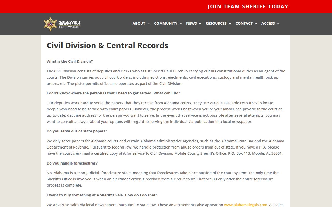
The Sheriff's Civil Division and Central Records page shown below identifies the official procedure.
A complete request should state the event or record sought without asking the office to assemble a general list of nearby people. For a current threat, use the appropriate emergency or published police channel instead of attempting more searches.
Mobile Neighbor Lookup Limits
Parcel searches leave major gaps by design. They do not establish renters, children, relatives, guests, utility customers, or all adults at an address. VoterView has an identity gate. Protected voter addresses are withheld. Probate redacts Social Security numbers and birth dates as allowed, and motor-vehicle information is restricted by federal law. A private community roster stays private unless its owner lawfully publishes it.
Alabama's Personal Data Protection Act was enacted in April 2026, but its consumer rights begin May 1, 2027. It does not erase original public records. Commercial opt-outs may suppress a profile, yet the property roll or court record remains with its custodian. Use Mobile neighbor data for civic curiosity, reconnecting, or personal safety awareness. Do not use it to monitor, threaten, or intrude on another person.
Lawful use. Mobile neighbor records support lawful personal research. Never use them to stalk, harass, threaten, impersonate, or intimidate anyone.